
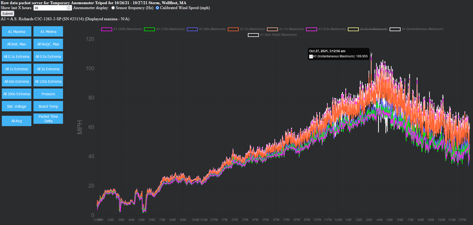
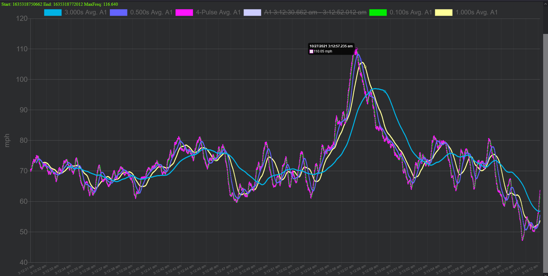
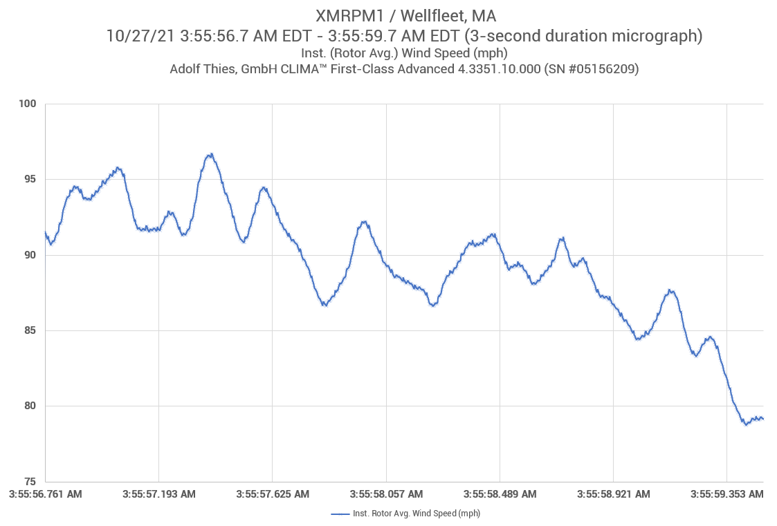
N.B.: For detailed info on the 110.0mph and 106.6mph inst. max gusts recorded in this event, scroll down to "Final Anemometrics" section below.
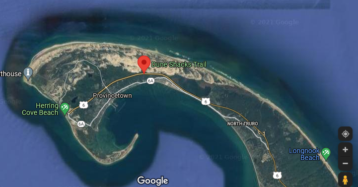
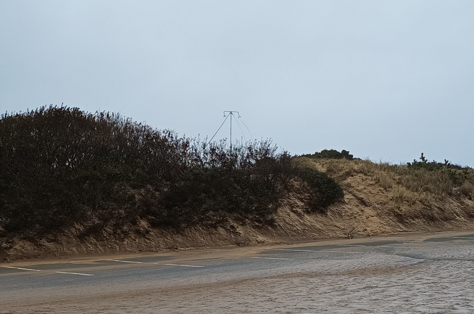
Two portable cellular anemometer tripods were positioned early on 10/26/21 on Cape Cod. The first featured an individually calibrated A.S. Richards high-speed anemometer and was placed at the White Crest Beach parking lot in Wellfleet, MA, 1.2km south of the fixed Wellfleet MAREPAM station for additional verification. The second tripod was placed on an elevated hiking spot along the Dune Shacks Trail in Provincetown, MA. The latter featured an individually calibrated First Class anemometer.
Both positions are highly exposed, elevated coastal locations accustomed to far stronger winds than residential/forested/non-coastal nearby areas. In comparing wind data readings, careful attention should be paid to this fact and also to the wind gust averaging length in use.
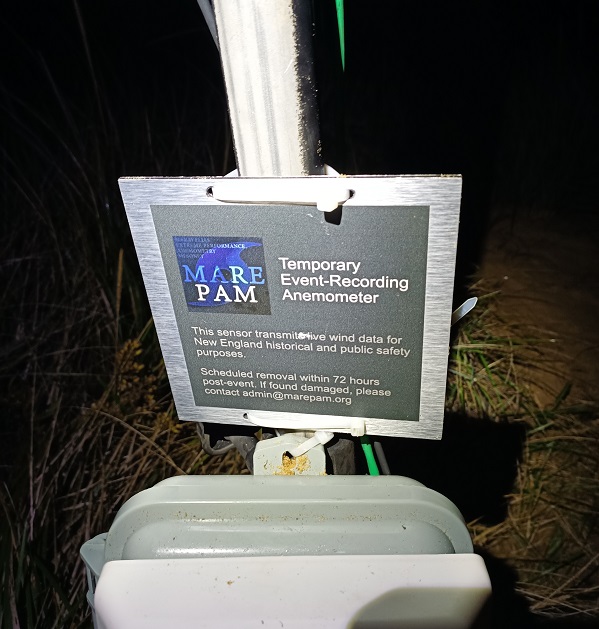
To ensure collection of proper and full wind gust averaging information, both anemometer tripods were outfitted with custom engineered MAREPAM sensor controllers, each streaming real-time data packets every 60s over LTE CAT-M uplink. MAREPAM controller firmware uniquely computes and transmits precise calculation of instantaneous, 0.1s avg, 0.5s avg, 1.0s avg, 3.0s avg, 60s avg, 120s avg, and 300s avg wind speeds. This enables proper comparison in context to different wind stations and to historical/climatological data adopting different wind averaging methods. To compare to METAR wind observations, the 3.0s avg should be used.
Anemometer #1: White Crest Beach, Wellfleet, MA
- Sensor ~11ft AGL
- Ground 73ft AMSL
- A.S. Richards C5C-1263-2-SP (Serial No. 25154) compact high-speed anemometer calibrated 9/23/2020 by SOH Wind Engineering, Inc. (Williston, VT, USA / Certificate PDF)
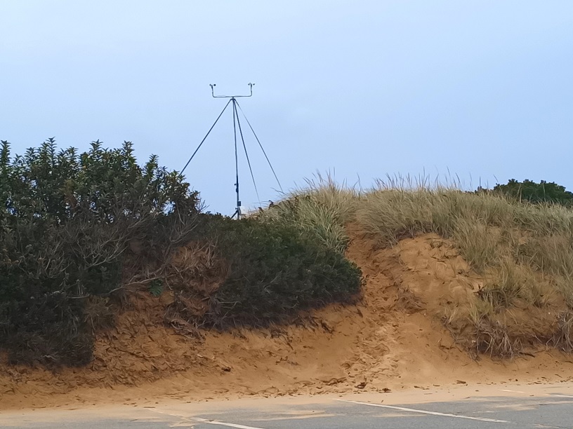
Anemometer #2: Unnamed hill, Dune Shacks Trail, Provincetown, MA
- Sensor ~12ft AGL
- Ground 112ft AMSL
- NRG Systems S1 Anemometer (Serial No. 94120000143) calibrated 9/27/2019 by SOH Wind Engineering, Inc. (Williston, VT, USA / Certificate PDF)