Two high-specification tactical cellular anemometer masts were deployed the night of 8/20/21 and removed post-event. Both were outfitted with custom engineered MAREPAM sensor controllers and one individually wind-tunnel-calibrated First Class anemometer. Real-time data packets using LTE CAT-M uplink streamed every 60s at high wind speeds and every 240s at low speeds. MAREPAM controller firmware delivered extreme precision computation and transmission of instantaneous, 0.1s avg, 0.5s avg, 1.0s avg, 3.0s avg, 60s avg, 120s avg, and 300s avg wind speeds.
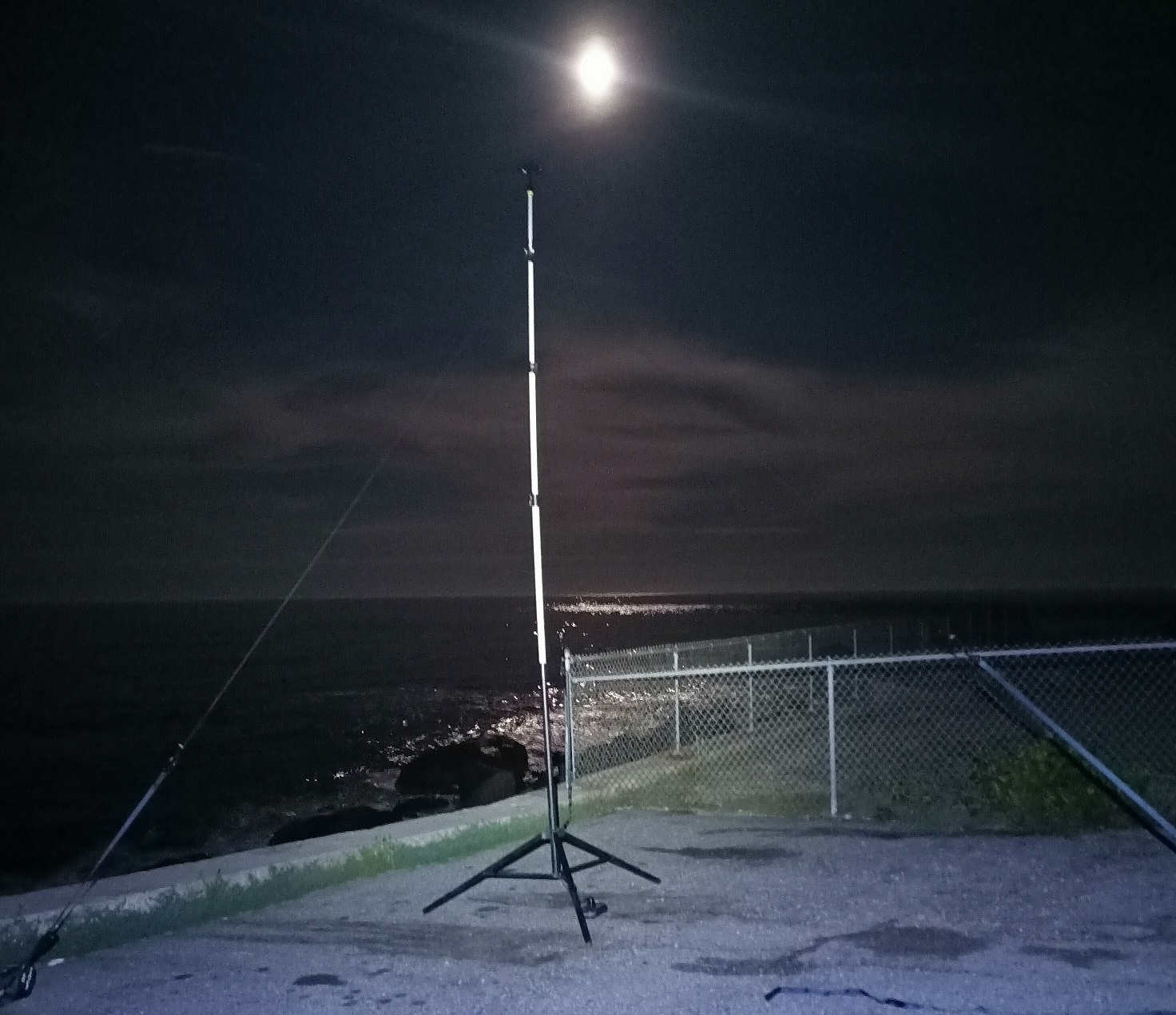
Anemometer #1: Watch Hill Point, Westerly, RI
- Sensor ~15ft AGL
- Ground 13ft AMSL
- NRG Systems S1 Anemometer (Serial No. 94120000143) calibrated 9/27/2019 by SOH Wind Engineering, Inc. (Williston, VT, USA / Certificate PDF)
- Photograph:
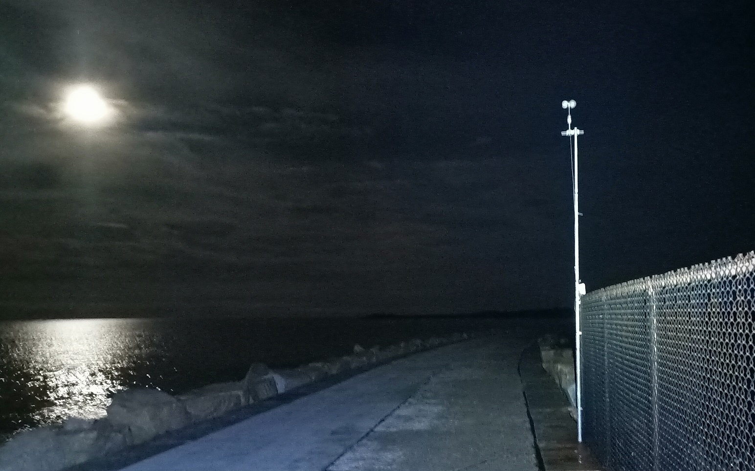
Anemometer #2: Gooseberry Island Causeway, Westport, MA
- Sensor 15ft AGL
- Ground 8ft AMSL
- WindSensor P2546C Anemometer (Serial No. 34525) calibrated 4/27/2015 by Svend Olen Hansen, ApS (Copenhagen, DK / Certificate PDF)
- Photograph:
Temporary Anemometer #1: Watch Hill Point, Westerly, RI
- Maximum Instantaneous: 54.9mph @ 14:46:02 UTC
- Maximum 0.1s Average: 54.7mph @ 14:46:02 UTC
- Maximum 0.5s Average: 54.2mph @ 14:46:02 UTC
- Maximum 1s Average: 52.9mph @ 14:46:02 UTC
- Maximum 3s Average: 51.3mph @ 14:46:03 UTC
- Maximum 60s Average: 40.9mph @ 14:54:15 UTC
- Maximum 120s Average: 38.5mph @ 14:54:54 UTC
- Maximum 300s Average: 36.6mph @ 14:57:06 UTC
- Sensor 15ft AGL / Ground 13ft AMSL
- Full tabular data (PDF)
Temporary Anemometer #2: Gooseberry Island Causeway, Westport, MA
- Maximum Instantaneous: 61.2mph @ 13:27:25 UTC
- Maximum 0.1s Average: 60.6mph @ 13:27:25 UTC
- Maximum 0.5s Average: 60.2mph @ 13:27:26 UTC
- Maximum 1s Average: 59.5mph @ 13:27:26 UTC
- Maximum 3s Average: 56.6mph @ 14:56:55 UTC
- Maximum 60s Average: 47.2mph @ 14:54:26 UTC
- Maximum 120s Average: 46.5mph @ 15:10:48 UTC
- Maximum 300s Average: 46.1mph @ 15:11:13 UTC
- Sensor 15ft AGL / Ground 8ft AMSL
- Full tabular data (PDF)
MAREPAM XMRPM3 / Block Island, RI / Selected Vector Instruments, Inc. A100LM Anemometer (SN #9881-C930)
- Maximum Instantaneous: 71.4mph @ 13:55:03 UTC
- Maximum 0.1s Average: 70.2mph @ 13:32:16 UTC
- Maximum 1s Average: 64.0mph @ 13:32:16 UTC
- Maximum 3s Average: 56.3mph @ 13:55:04 UTC
- Maximum 60s Average: 42.0mph @ 13:34:49 UTC
- Maximum 300s Average: 39.4mph @ 13:36:15 UTC
- Sensor 18ft AGL / Ground 144ft AMSL
- N.B.: Real-time QC algorithm for FW8194 CWOP/MADIS upload adopts strictly conservative filtering limits. These emitted a peak of 68.4mph during the event. Post-review of raw individual sensor data confirms veracity of the 71.4mph instantaneous maximum gust on the Vector A100LM. All readings from this sensor remained within the preset momentum/acceleration limit QC filter of 2.4% pulse-to-pulse max deviation on continuous 13-pulse average. See full tabular data below.
- Full tabular data (PDF)
The fixed Block Island Southeast Lighthouse MAREPAM station was installed in summer 2020 and was already optimally prepositioned to intercept this event. Data access information follows.
MAREPAM XMRPM3 / Block Island, RI (RAW) (CWOP/MADIS FW8194) (Wunderground KRIBLOCK10)
